








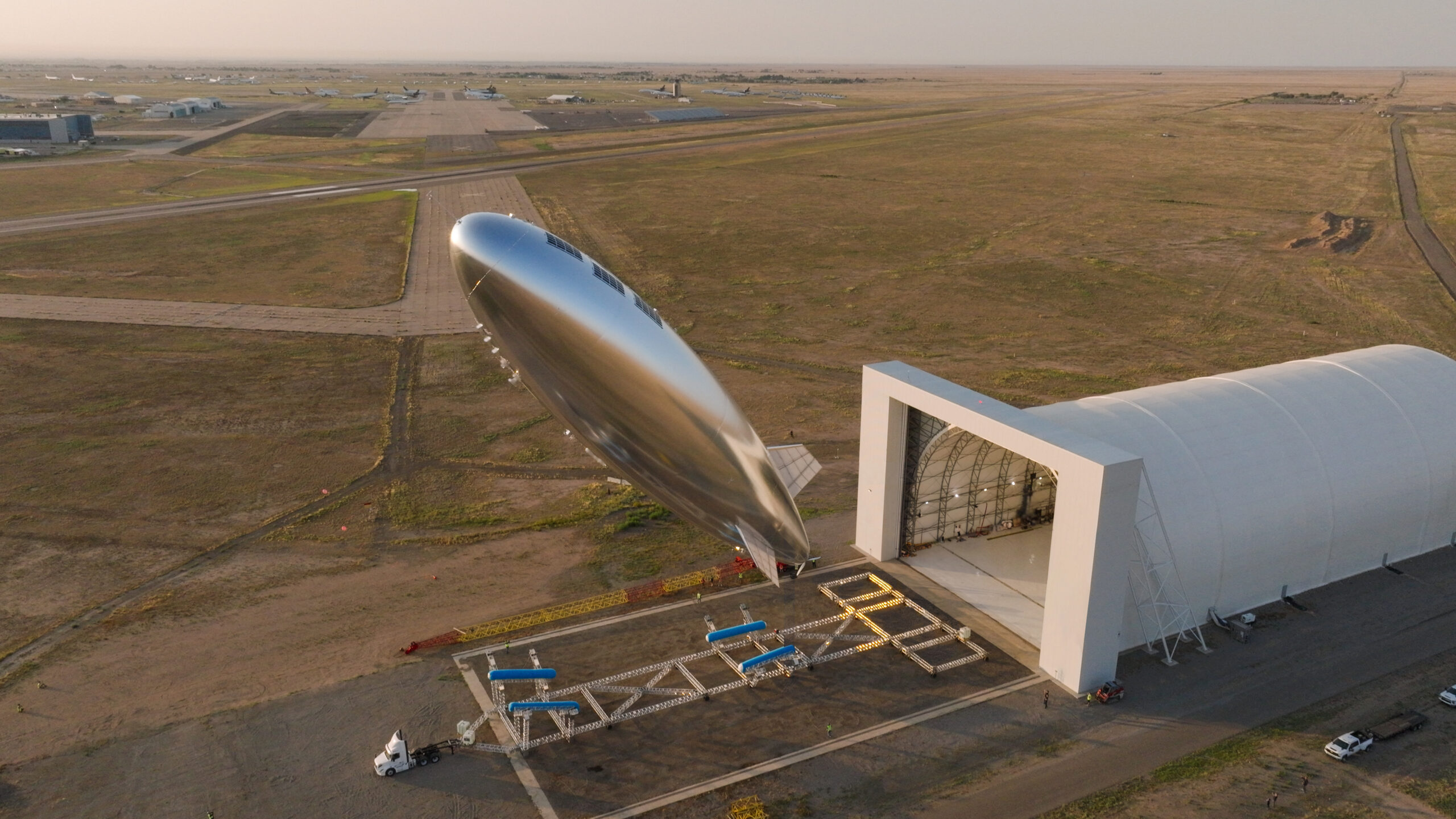
The lighter-than-air platform has also benefited from advances in material sciences that “were either not discovered or not understood back in the late 1990s,” Frandsen said. He highlighted the example of the discovery of graphene in 2004, which “greatly helped us optimize strength relative to weight on our hull, the energy density of our batteries, and performance relative to the area and weight of our solar panels.”
The design could eventually scale up to a high altitude platform system (HAPS) capable of lifting payloads as heavy as 551 pounds (250 kilograms). That would be between 25 and 50 times more payload capacity than competing stratospheric platforms such as high-flying drones, according to Helena, a US nonprofit organization with a for-profit investment arm that has invested in Sceye.
Sceye’s current platform has already done multiple flight demonstrations with payloads exceeding 220 pounds (100 kilograms) and can provide up to 1 kilowatt of onboard power capability for any devices that it may be carrying.
A heavier payload and higher power capacity opens the door to bigger mission possibilities, such as someday using a single Sceye platform hovering in the stratosphere to provide mobile broadband coverage equivalent to 500 ground-based cell towers. That may prove useful for both enhancing commercial telecommunications services and providing emergency coverage during disaster scenarios.

Credit:
Sceye
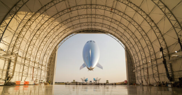
Sceye’s high-altitude platform system (HAPS) seen from inside its hangar after launching from New Mexico on August 9, 2026.
Credit:
Sceye
Crossing the Pacific
The concept was put to the test after Sceye’s platform launched from its New Mexico base on August 9, 2026, and traveled more than 9,320 miles (15,000 kilometers) across the Pacific to reach Japan. That 13-day journey required the airship to navigate through strong winds and avoid potential bad weather “during a window of typhoon season,” said Johnny Truong, chief technology officer of Sceye.
The stratospheric platform has an auto-navigation system that allows the airship to fly on its own between point A and point B while accounting for factors such as local wind conditions, Truong explained. That frees up human operators to focus on big-picture decisions such as monitoring weather forecasts, running flight simulations for possible paths, and then chaining together a series of navigational waypoints for the smoothest possible journey.


